Liberation Route Europe: a digital ecosystem to tell the story of Europe’s liberation.
By Khalid Yagoubi - Published : 17 Feb, 2025
5 min read

In 2020, the Liberation Route Europe Foundation (LRE) entrusted us with a major mission: to make the history of Europe’s liberation during World War II accessible, both online and on-site.
The objective: to connect over 3,000 km of trails, hundreds of memorial sites, historical accounts, archives, and local testimonies into a unified, multilingual, high-performance, and scalable platform.
Today, this platform has become one of Europe’s most significant digital ecosystems dedicated to remembrance.
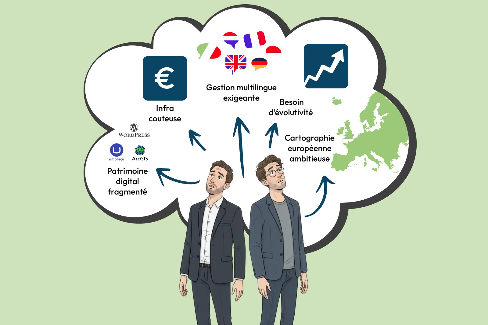
The challenge: Unifying, structuring, and showcasing a scattered historical heritage
Before our intervention, LRE faced several major obstacles:
1. A fragmented digital heritage
Content was scattered across Umbraco, WordPress, ArcGIS, QGIS, and other external sources.
The result: Complex maintenance, a lack of consistency, and significant difficulty in scaling the entire system.
2. Large-scale European mapping
Handling thousands of data points and trails at a continental scale demands a robust geospatial architecture and deep technical expertise.
3. Demanding multilingual management
The platform had to operate in six languages while ensuring consistency, editorial quality, and a seamless workflow for administrators.
4. A costly and complex infrastructure to maintain
The previous Azure setup was becoming rigid, expensive, and ill-equipped for scaling or future developments.
5. A clear need for scalability
LRE wanted the ability to easily add new frontends, digital experiences, and future applications without a complete system overhaul.
Our solution: A robust, scalable, and data-centric platform
We designed a complete digital ecosystem based on a unified backend capable of powering multiple web frontends, a cross-platform native mobile app, and future experiences.
1. Data Centralization and Governance
We consolidated existing platforms into a consistent, extensible data model designed to stand the test of time.
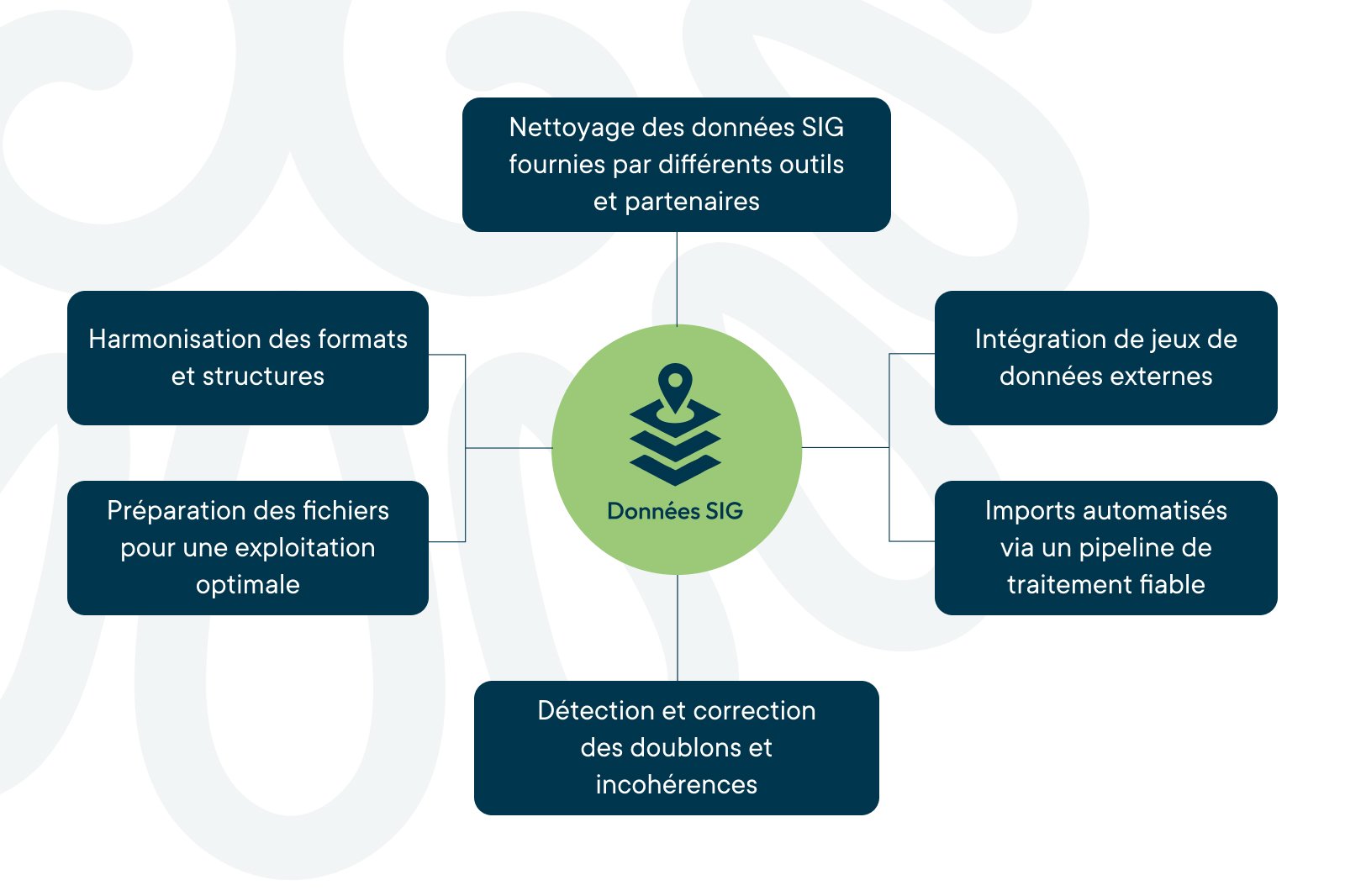
GIS Data: Cleaning, Harmonization, and Import
Our role in the GIS chain is clear and proven:
- GIS data cleansing from various tools and partners.
- Harmonization of formats, metadata, and structures.
- File preparation for optimal exploitation.
- Detection and correction of duplicates and inconsistencies.
- Automated imports via a reliable processing pipeline.
- Integration of external datasets, such as Knooppunten networks (cycling nodes).
Note:The drawing, modification, and geographical validation of routes are handled by an external GIS specialist.
KERN-IT ensures this data is transformed into a clean, consistent, and actionable digital asset.
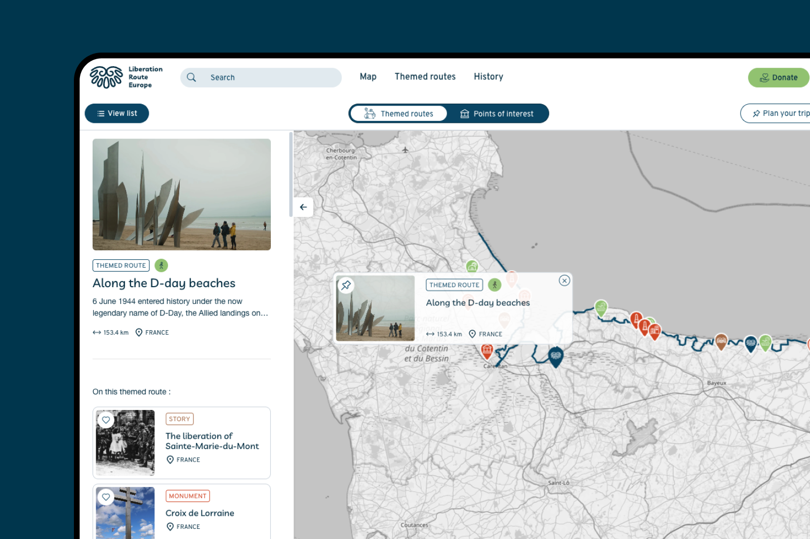
2. A smooth, high-performance European mapping system
We designed a mapping interface capable of handling thousands of data points and trails while remaining fluid, even on mobile devices.
To achieve this level of performance, we implemented:
- Dynamic geometry simplification
- Intelligent clustering
- High-performance progressive loading
- Dedicated geospatial caching
- Advanced mobile optimization
The result is a fast, clear, and engaging map that remains easy to explore, even with massive amounts of data.
3. Optimized multilingual management for maximum efficiency
The platform operates in six languages thanks to a multilingual system designed to reduce editorial workload and eliminate errors.
Our solution empowers LRE teams with:
- Assisted automated translation
- Smart content fallback systems
- Real-time multilingual previews
- Structured, role-based publishing workflows
- Comprehensive language monitoring dashboards
Multilingualism is no longer a barrier, but a powerful engine for international growth.
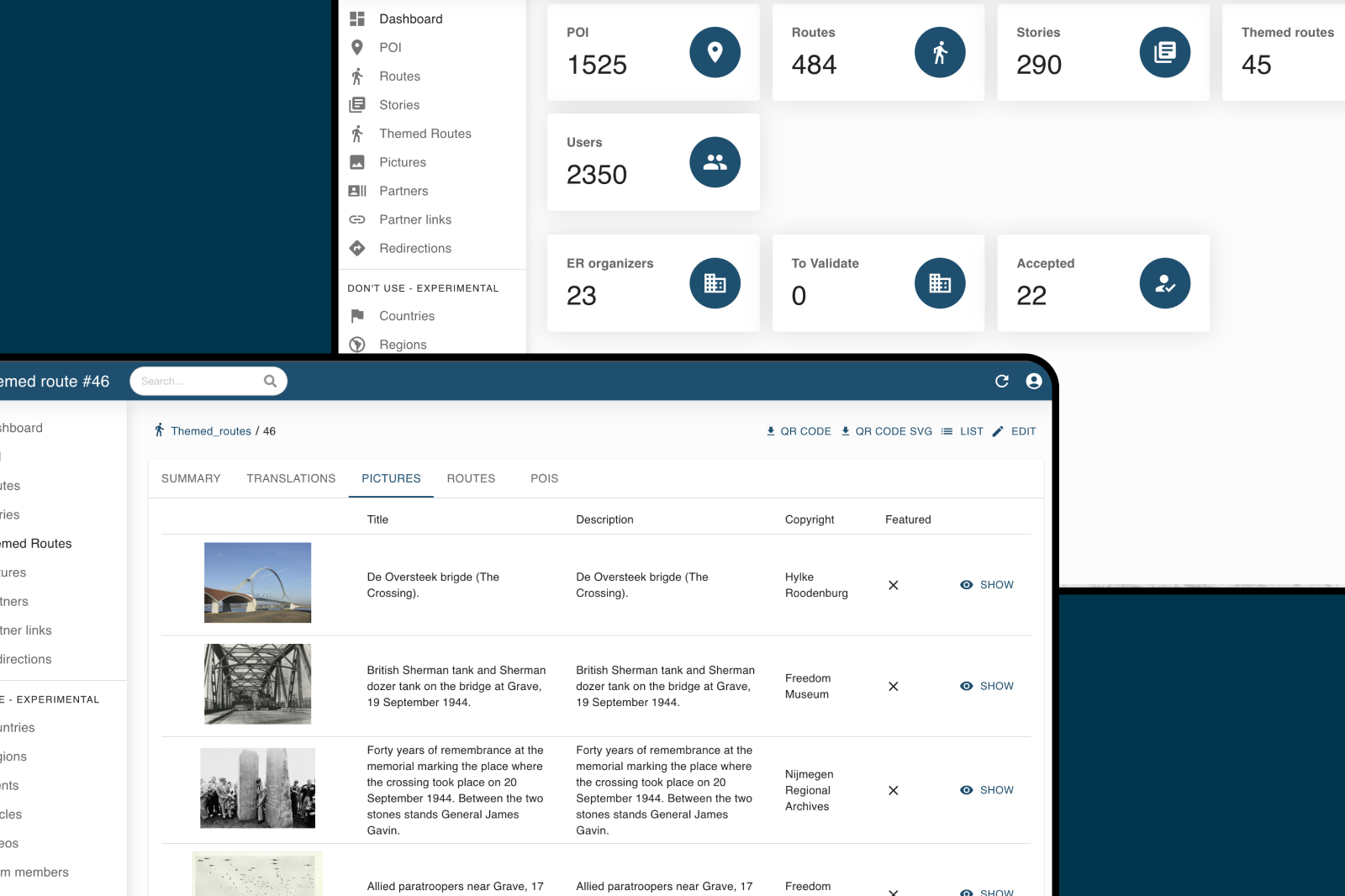
4. Custom back-office for LRE teams
We developed a custom admin environment tailored to their workflows, featuring:
- A route editor with live map visualization
- An advanced translation management module
- Real-time content previews
- Role-based permissions and approval workflows
- Automated import pipelines
The back-office is clear, powerful, and perfectly tailored to LRE’s day-to-day needs.
5. Optimized infrastructure: Lower costs, higher scalability
We re-engineered the architecture to deliver:
- Significant savings on infrastructure overhead
- Robust uptime and system stability
- Fluid scalability during peak usage
- Lower technical debt and easier maintenance
- The ability to power multiple frontends simultaneously
The central backend now provides a solid foundation for both current and future frontends.
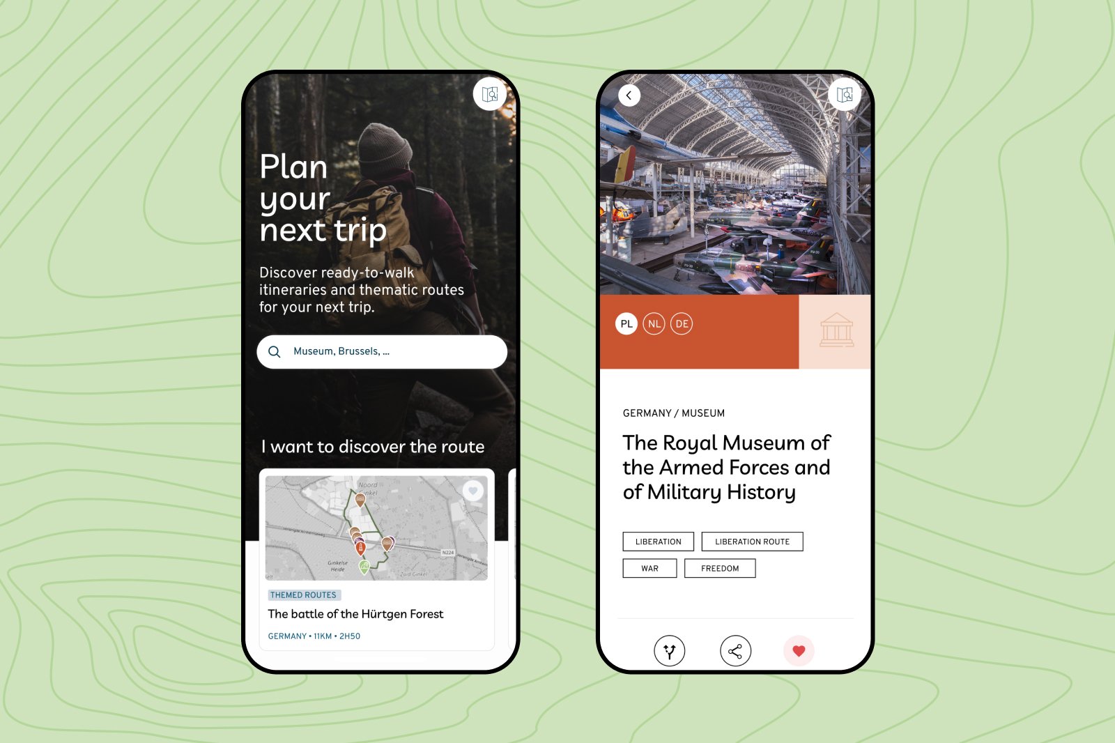
6. A native cross-platform mobile application
We developed a native cross-platform mobile application (iOS and Android) featuring:
- GPS navigation on the Liberation Routes
- Offline mode for areas with limited coverage
- Seamless access to content synced with the backend
- Field-optimized interface for outdoor use
The app extends the visitor experience and amplifies the platform's impact.
7. AI, augmented storytelling, and community engagement
AI-Remembers: A strategic European initiative
Within the framework of the European AI-Remembers project, we are exploring with LRE how artificial intelligence can enrich and enhance the platform.
Objectives:
- Automatically link archives, locations, and testimonies
- Generate personalized narratives
- Support historians and cultural mediators
- Develop a deeper understanding of the content
Toward new community-driven features
The platform is evolving toward:
- Moderated local contributions
- Promotion of museums and local stakeholders
- Enriched and personalized narrative experiences
The ecosystem is progressively becoming a living, collaborative space.
The Results: A platform transforming historical storytelling
Since the launch of the new version, Liberation Route Europe has reached a broader, more international, and more engaged audience than ever before.
A rapidly growing international audience
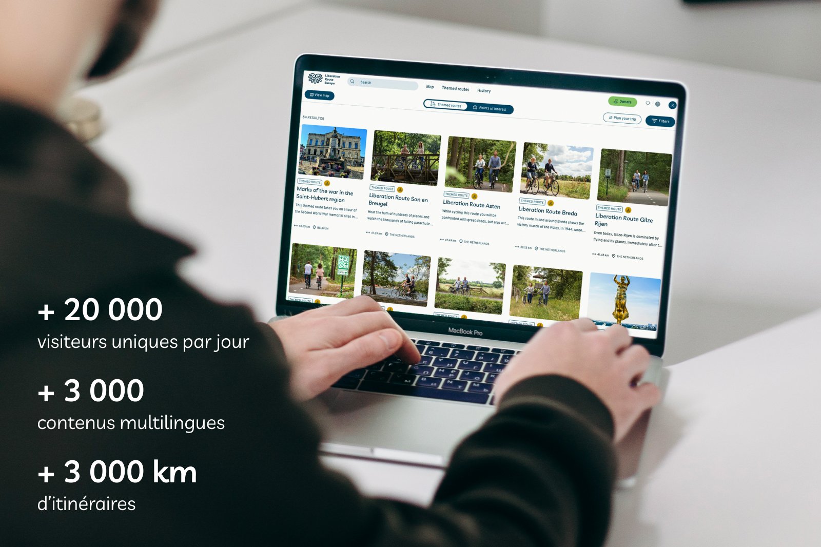
The platform now welcomes over 20,000 unique visitors per day, with traffic peaks reaching several hundred simultaneous users.
Thanks to the optimized infrastructure, these significant surges are handled seamlessly without any slowdown.
A structured, living, and enriched digital heritage
The editorial corpus has grown from 600 to over 3,000 multilingual items, interconnected and perfectly structured.
The 3,000+ km of routes now form one of the richest digital cartographic collections of historical memory in Europe.
An architecture built to last
LRE now benefits from:
- A robust backend capable of powering multiple frontends
- An optimized infrastructure that is scalable and cost-effective
- A native cross-platform mobile application
- A reliable and extensible data model
- A solid foundation for AI initiatives and future cultural experiences
The platform can evolve with confidence, matching the organization’s growing ambitions.
A long-term strategic partnership
With over 1,000 man-days invested since 2020, the project is built on a lasting collaboration based on:
- Deep knowledge of historical memory and storytelling challenges
- Technical expertise tailored to cultural heritage needs
- A shared vision focused on innovation and international accessibility
Today, Liberation Route Europe has a platform that amplifies its global impact and paves the way for future developments.
Do you have a project in cultural heritage, history, or tourism?
At KERN IT, we help cultural, tourist, and historical institutions design ambitious, high-performance, and sustainable digital platforms.
Our Key Expertise:
- Advanced Mapping
- Cultural Heritage Data Engineering
- Multi-frontend Platforms
- Native Cross-platform Mobile Apps
- Infrastructure Optimization
- AI Applied to Cultural Heritage
Contact us to discover how we supported Liberation Route Europe and how, together, we can bring your vision to life.